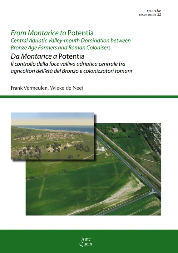
New book publication on prospections and excavations in the Potenza Valley
Frank Vermeulen and Wieke de Neef (eds.), From Montarice to Potentia: Central-Adriatic Valley-mouth Domination between Bronze Age farmers and Roman colonizers. Bologna, Ante Quem.
The Potenza Valley Survey project, carried out between 2000 and 2021 by an international team of specialists, represents one of the most important archaeological research initiatives in the Marche region (Adriatic Italy). The project has brought to light significant data on the history and evolution of the coastal landscape around the mouth of the River Potenza. The research has shown that two key sites near present-day Porto Recanati – the protohistoric hilltop settlement of Montarice and the Roman town of Potentia – played a central role in shaping the surrounding coastal landscape and in organizing settlements and socio-economic activities over the long term, particularly between the Bronze Age and the Roman period. This volume presents the main findings of the research and offers a diachronic perspective on human presence and activities in this part of Italy and along the Adriatic coast.
The book will be presented in the Swabian castle (Castello Svevo) of Porto Recanati on Thursday 16 July 2026 at 18.00. All welcome!
New ArchPro research in the Armenian Highlands
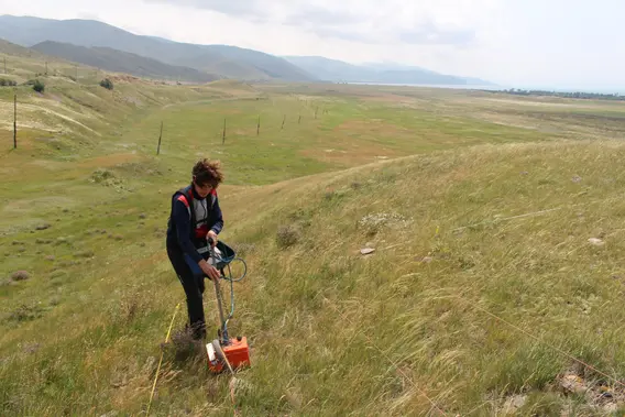
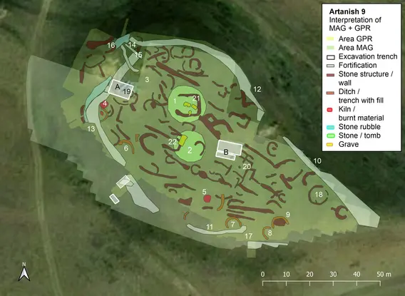
Between 2022 and 2024, ArchPro was involved in the complete mapping of an Early Bronze Age (EBA, ca. 3500-2400 BC) hilltop settlement in the Armenian highlands. Artanish 9 is the first EBA site in the southern Caucasus that was completely mapped using geophysical techniques (Magnetometry and Gound Penetrating Radar). An exceptional result of these non-invasive surveys is the massive fortification wall enclosing the settlement. Subsequent excavations confirm that the wall and the domestic structures inside were built at the same time. This layout is an anomaly in the Southern Caucasus, where the EBA is often described as peaceful and egalitarian. This leads to interesting new questions about the socio-economic and socio-political structure of EBA communities in this mountain landscape. Why did they build the wall?
The geophysical surveys are now published in open access in Antiquity! You can read it here
We will continue to investigate Artanish 9 in 2026. With generous support by the Gerda Henkel Stiftung, we will start a landscape archaeological study of the site's surroundings in September 2026. Staff and students of ArchPro will, together with colleagues of the University of Halle and the Armenian National Academy of Sciences, work on new geophysical surveys, fieldwalking, coring, and remote sensing to characterize settlement and land use in the highlands to the north-east of Lake Sevan.
More info: wieke.de-neef@uni-bamberg.de